News Story
Snow Is More Complicated Than You Think
This article appeared originally in the Department of Civil and Environmental Engineering's 2018 alumni magazine, Civil Remarks. Find more stories at go.umd.edu/civilremarks.
The old adage that no two snowflakes are alike may not be wholly true, but it captures the complexities scientists grapple with when quantifying just how much water is stored in the ice crystals blanketing earth. That measurement is known as snow-water equivalent (SWE), and on it turns global climate models, water supply projections for more than a billion people, and policies in areas like sustainable agriculture and energy production.
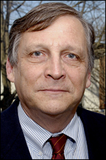
“Despite its importance, we still do not really know how much snow exists in the world,” said Barton Forman, an associate professor in the Department of Civil and Environmental Engineering (CEE) and the Deborah J. Goodings Professor of Engineering for Global Stability.
Snowpacks vary substantially by location and across time. They can be powdered or packed, thin or dense, coarse or smooth, dry or slushy—and each characteristic interfaces with sensors and models differently. What’s worse, the expansive range of snowpacks makes measuring them with land-based tools alone nearly impossible.
So Forman and his research team have taken to space. Through partnerships with NASA’s Ames Research Center and Goddard Space Flight Center, the eight-person team is scrutinizing an array of existing and potential satellite sensors for a combination that will together lead to more accurate SWE measurements.
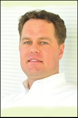
“There are pros and cons to every sensor,” explained Yonghwan Kwon, a CEE postdoctoral associate, adding that no one sensor can measure SWE directly. “Passive microwave sensors, for example, can detect energy emissions from snow through cloud cover and give useful information if the snow is cold and dry. But its accuracy drops significantly when the snowpack becomes wet or if it is covered by forest or near lakes and rivers.”
Forman, Kwon, and the rest of the team are focused first on stress testing the remote sensing method lidar for a potential satellite launch.
Lidar instruments reveal the distance to an object by calculating how long it takes a series of laser pulses to bounce back. By comparing readings taken when the ground was snow free and snow clad, lidar allows scientists to measure snow depth with greater accuracy than other remote sensing technologies.
“The problems are that lidar performs badly in cloudy conditions and loses accuracy the farther the sensor is from the object being measured,” Kwon said.
Over the next year, the researchers will continue to run computational experiments to pinpoint the design, flight path, and overpass rate a lidar satellite would need to deliver scientifically usable results. They plan to conduct similar experiments with passive microwave and radar instruments.
The team’s long-term goal is to develop prediction tools—similar to those used for weather forecasting—that climate scientists and decision makers can employ to develop more robust water models and policies.
“Predicting the future is incredibly powerful,” Forman said. “But before we can confidently predict the future, we have to be able to accurately describe the present.”
Published November 13, 2018
Related Stories
Stories / May 10, 2017
Liu, Xue Recognized for Scholarly Excellence
Stories / October 16, 2015
Baecher Awarded GEOSNet Distinguished Award for Lifetime...
Stories / July 14, 2014
Forman Awarded NASA New Investigator Award for Global Snow...
Stories / Jul 20, 2026
Ríos Ocampo Awarded NSF CAREER to Advance New Class of...

Stories / Jul 20, 2026
Building Bridges to Accelerate Innovation

Stories / Jul 15, 2026
New Tool Reveals Hidden Security Risks in AI Systems

Stories / Jul 14, 2026
High-Impact Studies Advance Next-Generation Batteries Through...

Stories / Jul 13, 2026
Meet the Newest Cohort of the MARC Program

Stories / Jul 13, 2026
University of Maryland Named Top Contributing Institution in...

Stories / Jul 10, 2026
MATRIX Helping Maryland Build Tomorrow's Workforce

Stories / Jul 10, 2026
2026 Counterfeit Parts and Materials Symposium at College Park
Stories / Jul 9, 2026
Hands-On Workshop Prepares Students to Design for Compliance

Stories / Jul 9, 2026
Alchemity Announces New Seed Financing
