News Story
Syria-Turkey Earthquake: Researchers Conduct Geotechnical Study
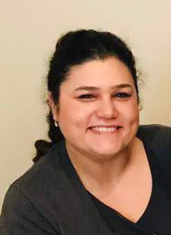
Dr. Asli Dayioglu. Istanbul Technical University.
The 7.8 magnitude earthquake that struck southern Turkey and parts of Syria on February 6 was one of the strongest and most devastating ever recorded in the region. It caused more than 55,000 deaths and left tens of thousands of buildings–including apartment complexes, schools, and hospitals–in ruins.
With the disaster prompting calls for a revamp of building codes and tighter enforcement, a team of researchers from Istanbul Technical University conducted on-site observations of the damage wrought by the quake. The four-person team included Istanbul Technical University (ITU) assistant professor Dr. Asli Dayioglu, who received her doctorate from the University of Maryland in 2016.
While at UMD, Dayioglu studied with civil and environmental engineering professor Ahmet Aydilek and conducted her dissertation research on the beneficial use of steel slag, a by-product of steel industry, in geotechnical engineering practice. Her current research interests include development of sustainable and resilient infrastructures, image analysis, application of geosynthetics, environmental impact and risk assessment of construction/demolition waste and earthquake debris.
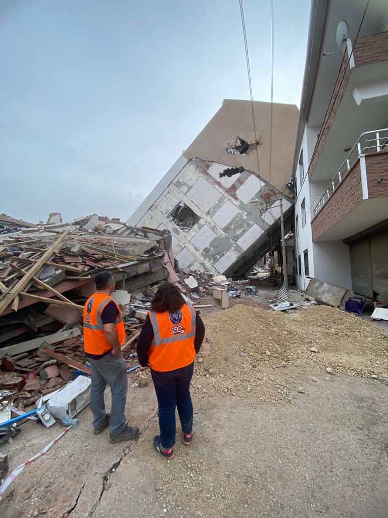
Drs. Asli Dayioglu (right) and Mustafa Hatipoglu of Istanbul Technical University examine collapsed structures in Golbasi, Turkey. Dayioglu is a graduate of the University of Maryland’s (UMD) doctoral program in civil and environmental engineering, while Hatipoglu is a former UMD postdoctoral researcher.
Dr. Dayioglu spoke with UMD recently about her team’s purpose in visiting the quake-afflicted areas in Turkey, the methodology used by the team, and the findings obtained from the study.
What was the objective of this project?
The main objective of the site visit was to evaluate the soil properties in the earthquake zone from a geotechnical earthquake engineering point of view and to observe the extent of structural damage on-site.
Who were the members of the project team?
The team consisted of three geotechnical engineers: myself, Dr. Mustafa Hatipoglu, and Dr Atila Sezen along with a structural engineer, Dr. Pinar Ozdemir Caglayan. All of us are on the faculty of Istanbul Technical University’s department of civil engineering.
What was the methodology used?
As you know, a total of 11 cities were affected by the earthquake. Our main goal was to see as many places as we could, so we rented a car and drove approximately 800 miles in 3 days. The accommodation options were extremely limited so we decided to stay in the city of Gaziantep, which was comparably less affected by the earthquake, and drive every day in a different direction. At the time of the visit, most of the debris was still in place. This allowed us to investigate the site visually to relate the extreme damage, displacement and deformation of the structures with local site conditions and topography.
What were the key findings/observations?
We found that regions that are located on bedrock were significantly less affected by the earthquake.
In zones where liquefaction phenomena—that is, loss of bearing capacity due to dynamic forces and instantaneous rise of pore water pressure—were observed, we saw characteristic types of damage, such as tilting of the building or excessive settlement. Fewer collapses were observed in such situations, however.
Regions located on alluvial soils were the most drastically affected. With increased distance from the lowland, the extent of damage significantly decreased. Also, the thickness of the alluvial basin and the three dimensional basin effect played a key role along with directivity and supershear rupture, which needs further investigation, on the heavy damage observed particularly in Antakya. Finally, due to the duration of the earthquake, buildings with 4-7 floors were the most affected.
Are there "action items" for various stakeholders (contractors, architects, customers. government authorities) based on your research?
No, there are not. This site visit was solely for the purpose of obtaining our own findings and observations and was self-funded. Neither the government nor any third party agency was involved.
What are next steps, if any?
A journal paper combining existing site data and numerical simulations is in progress. In the meantime, we continue brainstorming ways to improve and reinforce the existing structures both in the earthquake zone and in other potential earthquake areas.Turkey is an earthquake-prone country. We have to accept this and learn how to live with it.
Published June 12, 2023
Related Stories
Stories / July 15, 2015
CEE Launches Infrastructure Engineering Laboratories Renovation...
Stories / May 26, 2026
Apply: Chair of the Fischell Dept of Bioengineering

Stories / Jun 18, 2026
ECE Professor Kaiqing Zhang Receives Donald P. Eckman Award

Stories / Jun 15, 2026
Alisa Morss Clyne Named Interim Chair of UMD Bioengineering
Stories / Jun 9, 2026
The Future of Terps Racing is Electric

Stories / Jun 8, 2026
Alchemity receives Build our Future Award from Governor Moore

Stories / Jun 8, 2026
Shuna Ni Receives NSF CAREER Award

Stories / Jun 8, 2026
UMD Study Finds Critical Cloud Security Patches Often Never...

Stories / Jun 5, 2026
UMD Senior Joshua Mathew Wins 2026 Astronaut Scholarship

Stories / Jun 4, 2026
BIOE Graduate Program Receives Mentoring Excellence Award

Stories / Jun 4, 2026
Risk and Reliability in Space-Based Data Centers